|
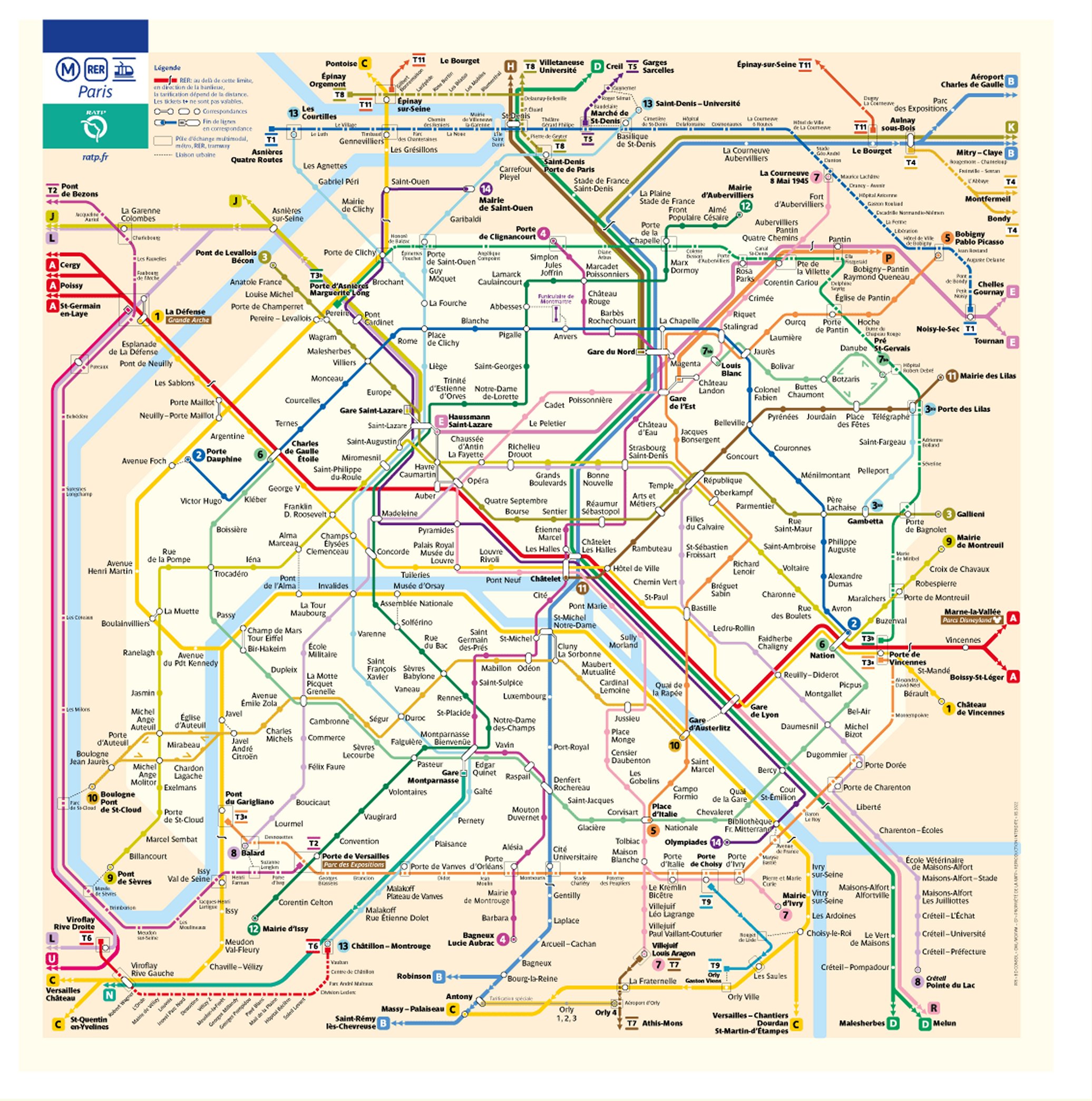
Home / Paris Metro Map (Interactive) Paris Metro Map - Interactive VersionIf you move your mouse over the following image of the Paris Metro Map, it will load a full-size version instead (but please note this may take a while the first time you do this) and zoom in on it. You will then be able to pan around the map to see all the details you may need (e.g. station names, line numbers).
This book is very good and a perennial favourite with lots of travellers, but you might like to check out the following popular Paris guide books too:
Copyright 2010 - 2024 ParisMetroMap.org (Part of R&M Publishing) |
||||||||||||||||||||
|
Paris Metro Map Home • Anti-Spam Policy • Compensation Disclosure Policy • Contact Us • Privacy Policy • Terms Of Use The owner of this website, Mark Stuart Farrar, is a participant in the Amazon Services LLC Associates Program, an affiliate advertising program designed to provide a means for sites to earn advertising fees by advertising and linking ParisMetroMap.org to Amazon properties including, but not limited to, amazon.com, endless.com, myhabit.com, smallparts.com, or amazonwireless.com. |
||||||||||||||||||||